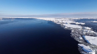
Right now, China’s 40th Antarctic scientific expedition is underway. The reporter learned from the China Polar Research Center that the scientific expedition team recently successfully completed an international cooperation mission for an aerial survey of the edge of the Antarctic ice sheet, filling the gap in ice sheet thickness and sub-ice terrain data, and further increasing the international influence of my country's Antarctic expedition.
China's 40th Antarctic Scientific Expedition actively carries out international cooperative research and cooperates with Norway, Australia and other countries to implement aerial survey missions to the edge of the Antarctic ice sheet. Not long ago, as the "Snow Eagle 601" fixed-wing aircraft successfully landed at the Zhongshan Ice and Snow Airport, China's 40th Antarctic Scientific Expedition successfully completed this international cooperation mission.
Lu Kai, an assistant researcher at the Institute of Polar Ice, Snow and Climate Change of the China Polar Research Center, said that this mission conducted an aerial survey of Enderby, the largest data blank area in Antarctica, and completed a cumulative flight of 7,200 kilometers and a flight time of about 28 hours. It successfully obtained Detailed ice thickness and subglacial terrain data on the edge of the ice sheet between Zhongshan Station in my country and Princess Elisabeth Station in Belgium were collected. These data will provide an important basis for accurate assessment of Antarctic ice sheet ice loss and its impact on global sea level rise.
The ice loss and potential instability of the Antarctic ice sheet is one of the important factors causing global sea level rise. Ice thickness and subglacial terrain data at the edge of the ice sheet are the basis for assessing the ice loss and instability of the Antarctic ice sheet. According to researchers, nearly 90% of the ice sheet edges lack accurate ice thickness and subglacial terrain data. .
Cui Xiangbin, a researcher at the Institute of Polar Ice, Snow and Climate Change of the China Polar Research Center, said that to this end, an international cooperation plan for aerial surveys of the edge of the Antarctic ice sheet has been launched. China is an important initiator and participant of this cutting-edge science program. The completion of this mission will, on the one hand, provide a basis for accurate assessment of ice loss and ice sheet instability in this region. On the other hand, it will serve as a good guide and demonstration for promoting the implementation of subsequent international cooperation plans. .